5.06.2011

underestimating milford

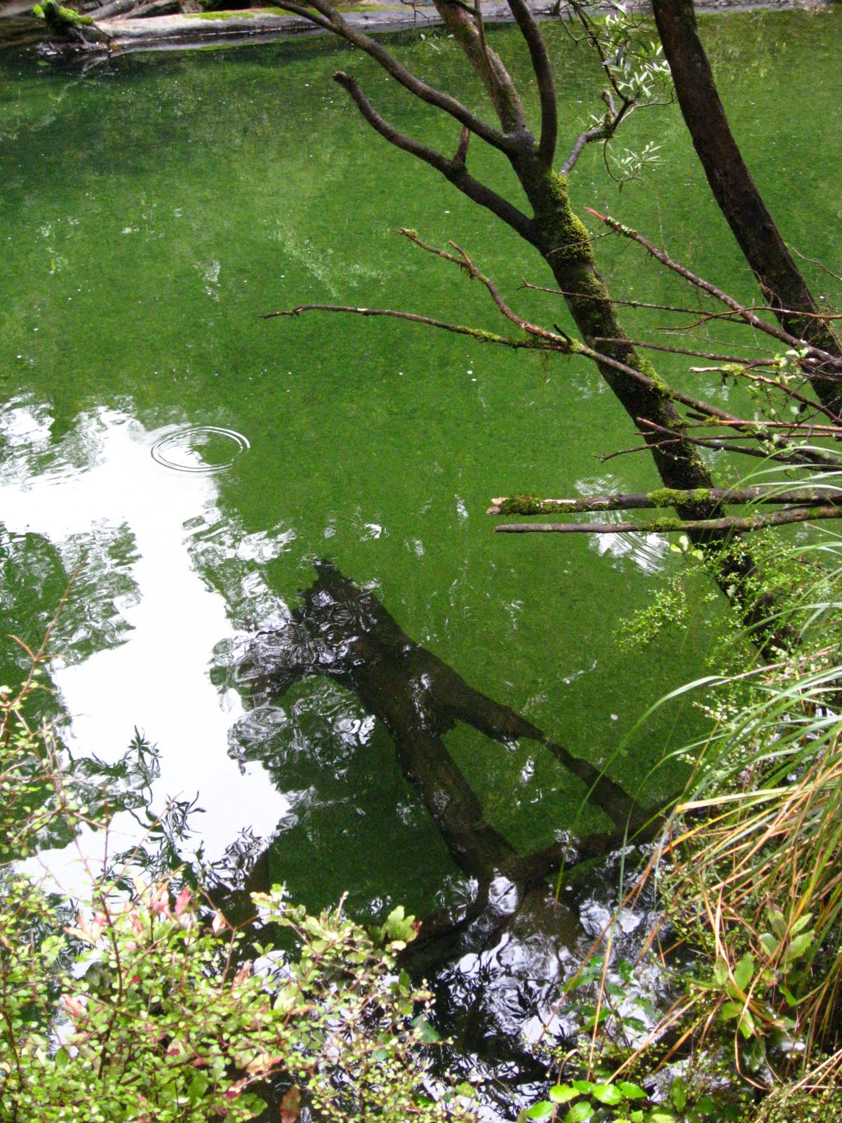
before you read anything else. i know i say a lot this stuff is amazing, beautiful, phenomenal and all these other rather vague descriptions of scale of greatness for this place but Milford goes beyond those. it is truly astounding and gives you goosebumps just to see. it feels like another planet. i can't really try to describe it more than that.

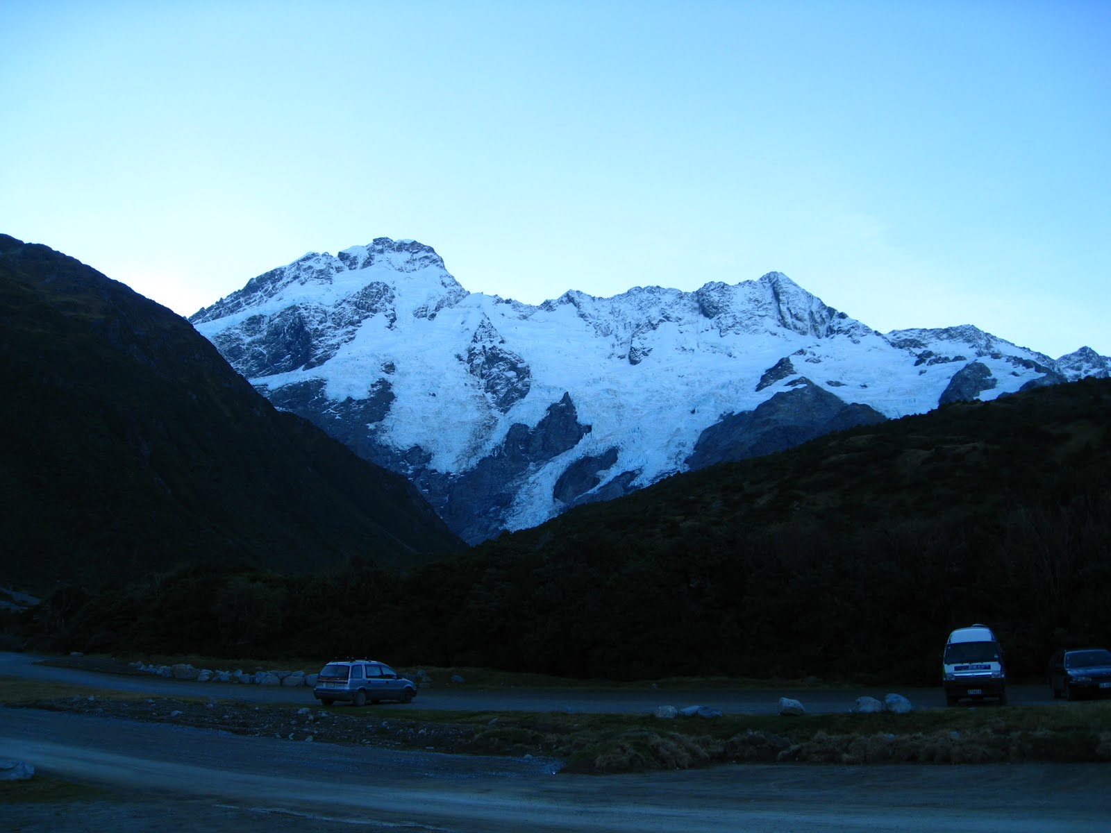
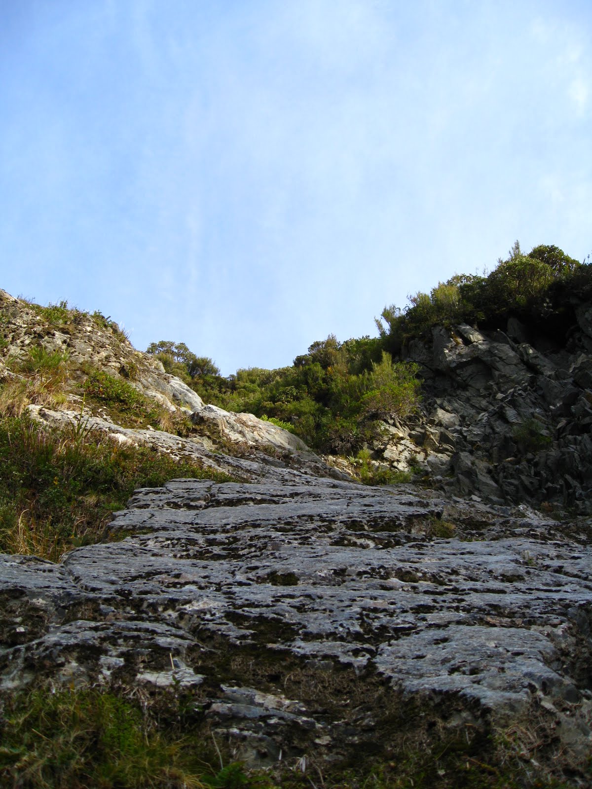
labeled as one of the most beautiful and astounding places in NZ, Milford Sound is fjordland in NZ. What's the difference between fjords and canyons or gorges? fjords are cut out from glaciers, canyons and gorges are from erosion by water and/or wind. the result is extremely steep cliffs and deep deep valleys.

the track is a one way track, not a loop. there's no camping, you have stay in these huts along the route. all the huts have treated water, fireplaces and bunks for 40 people. during the peak season (Oct-April) you have to have a reservation and you have to hike on a schedule because the whole place is booked, 40 people in a hut every night. on the shoulder seasons, especially may, there are stories of huts with 100 people in them and people sleeping on the floor because the limits are taken off.

the place is extremely isolated. there is absolutely nothing out there except these huts. it's a 2hr+ boat ride to the trail head, a 30 min boat ride from the end to a town of about 50 people and then a 2.5hr car ride back to where the boat started.

everyone is required to carry a locator beacon with them on the track and fill out intentions form that include a "panic date" where, if they haven't heard from you, then they start search and rescue. last year an Australian woman died, she took off her pack (with locator beacon attached), stepped off the track to take a picture or a pee or something and couldn't find her way back, they found her eight days later, five miles off the track and 20 miles away from where she left the track. the day i left, they were starting a search and rescue party for a U.S. Marine who said he'd be out two day before but never showed up. nobody on the trail had seen him for two days and he didn't have a beacon with him. even if you're by yourself with a beacon, if you break an ankle or something happens that you need a rescue, it's still about 36-48hrs before they can get to you.

you get the picture now how remote this place is?

the track is meant to be done in four days, three nights.
day one: boat ride and three miles to hut
day two: hut to hut, 10.25 miles and 1,500ft incline
day three: hut through mountain pass with 1,500ft incline over three miles then 2,700ft decline over five miles to hut
day four: hut to track end 11.5 miles

because it's the off season and you can take it at your own pace, i decided to combine day one a two.

DAY ONE:
i caught the boat at 8am. there are no other boats out there. there is nothing else out there. there are three other people on the boat. a brother and sister doing the track in 4 days. a british guy doing the track in three days like me. everyone is really nice. the boat captain is a little weird. the captain tells us combining day one a two is doable, says it's only 10 miles. later he says it's only 12-13 miles. before we get off the boat he says that we should be fine, it's only 15-16 miles.

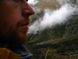
the british guy is Dan Clements. without really talking about it we set-off on the track together and did the whole thing together.

Dan is 38, worked in IT, quit and was a partner in a bicycle shop chain in England for 13 yrs before quitting to visit NZ and reevaluate. he's a trained mountaineer, knows how to navigate with a compass and map, knows how to pace, has climbed some mountains and also done a fair amount of rock climbing. he carries a garmin gps tracking device that tells us how fast, far and high we've climbed. he's about 5'6 and 185lbs. what a catch.

day one was completely fogged in with a cloud ceiling of 150ft. we started walking at 11am and got in to the hut to by 4:30 or so. the cloud level didn't lift until the last mile before the hut. the map said it was supposed to be just over 13 miles. Dan's gps said it was over 14.

when we got there, there were 4 other people at the hut for the night. all of us would be on the same schedule for the rest of the trip. Dom and Susan; Dom is from Australia and Susan is from San Fransisco. they've been together for over two years. they met traveling in Alaska. Dom is lawyer, Susan works for Google. they're in their late 20's, early 30's. the other two are two girls hiking together. one is from NZ, one is from Australia. they both work as biology/ecology researchers.

the clouds cleared when we got to the hut and Dom mentioned that sunset at the pass is supposed to be amazing. it'd be another three miles each way with a 1,500ft incline/decline. i decide i'm up for it because with the pack off, i felt like a spring chicken even though that'd put my mileage at over 20 for the day.

by the time we get up there the clouds start rolling back in and it was getting dark. it was pretty amazing. the most impressive part was 12-second drop. i didn't stick my head too far out over the edge but it looked like a straight drop. somebody needs to go base-jump that.

we made it back fine in the dark with head lamps.

dehydrated spaghetti for dinner.

DAY TWO:
up and out early. the highlight of breakfast was pre-packed pancakes with nutella i brought.

up and over the pass again. it was amazing. 

dinner was dehydrated mexican chicken. i didn't realize it until i dug in but it was Cinco de Mayo. booyah. no margaritas though.

DAY THREE:
up and out by 9:30am to catch our 2:30pm boat pick-up. rain to start but it cleared out eventually. the track ends at Sandfly Point. due to the name, i wasn't inclined to get there much earlier than 2:30. we got in at 2:25. our boat drivers name was Sam. he said, "two Sams don't make a right." i replied, "two Sams make it better though." 

TOTAL:
everything i read said it was 53 km (32 miles). Dan's gps said it was 60 km (37 miles). including my hike to the pass for sunset, that would have been 70 km (43 miles) in three days or 63 km (38 miles) if you're a pessimist. oof.

THE BEST PART:
the boat ride back. it was little inflatable dinghy. everyone sat on the inflatable walls with nothing to really hold onto. bouncing across the water back to town with our packs in the bow, nothing was in site and the only thing keeping us on board was our balance in this isolated fjord sound. it felt overwhelmingly powerful. it was the first time i really grasped how isolated i was with those people. but we were all together in that boat and maybe that's what gave it that feeling.
nice...

our boat ride


rivers along the way were unbelievably clear. you could easily seen to the bottom of everything, some spots as deep as 15 ft.

park caretaker's hut and dinner hanging outside. i think it's deer.
the pass in the distant fog
waterfall.
there were lots of waterfalls.
can you tell where the cliff ends and the water begins?
clearing clouds on day one.

summit face
memorial at the top of the pass
looking back down valley we hiked up from the pass.


the tallest waterfall in NZ.

another waterfall.
Happy Cinco De Mayo.

sometimes, taking pictures of yourself don't work very well.
the end
victory fist pump
the group
i wanted a picture of Dan. he requested we do a victory jump like true Americans. did you know American's did victory jumps?
sandflies
our fearless boat captain, Sam
Dan Clements


eastbound and down

it's been just over a week since my last post coming out of Arthur's Pass and the Cantebury region. since then i've been to Methven, Lake Tekapo, Lake Pukaki, Mt. Cook, Lake Wanaka, Queenstown and Milford Sound.

the legs are tired, i need to do some laundry and every day i internally debate getting a haircut.

The best friday night yet
i know you probably think it would involve a fair share of alcohol and locals but that's not the case. i stayed in Methven after hiking in Arthur's Pass. Methven is the biggest city close to NZ's largest ski fields. it's pretty quiet outside of the ski season (June-Aug).

i got into town around 6, parked behind a hostel and paid them $5 to use their facilities. made a quick dinner, had a beer and then rushed off to catch Get Low, i saw a poster for it in a town a couple weeks ago and wanted to see it but didn't have the time then. I know, how do i not have time? i don't know, i just didn't then. anyway, it was playing in Methven. Bill Murray is in it = guaranteed winner. it's about a old guy that throws a party for his funeral before he's actually dead. a concept i'm sure we've all thought about but probably never thought about inviting Bill Murray.

i walk up to the theater and it's a really cool little privately owned place. they've got one big room in the back that probably hold 50 people or so and then a small room that seats 12. i was the only person there so it was in the small room. the place serves beer too so i had one. i got up to pee halfway through and she paused the movie for me and gave me another beer just because. it felt like a private showing or something. it was awesome.

Lake Tekapo
a big teal-blue lake located on the central plains of the alps on the South Island. i stopped in for an hour or so, did a quick hike up a hill, took some pictures and moved on.


Lake Pukaki
it's a creepy looking milky-blue thing that runs the valley all the way up to Mt. Cook and national park that holds 22 of the 27 NZ peaks over 10,000 ft. there are some pretty spectacular views.


Aoraki/Mt. Cook
in the past three years i've started hiking and climbing some small mountains around WA. the biggest i've knocked off was Mt. Rainier at 14,400+ ft and Mt. Adams at 12,200+ ft. Mt. Cook is just over 12,300 ft but far far more imposing than anything i've seen before. it's a big nasty, jagged looking thing. Mt. Rainier and Adams are both like like big mounds of snow compared to this guy. Mt. Cook was also the training ground for NZ native, Sir Edmond Hillary in his summit of Mt. Everest if that gives you any idea of just how serious this thing is. summit attempts involve a helicopter ride to a starting point and serious mountaineering skills. just looking at it has me questioning how you even get close because the sides of it look like sheer vertical climbs with glaciers barely hanging on. i have no plans to try to summit it.

instead i hiked to Mueller hut. it was a solid 3+ hr hike over 3,300 ft. it heads up this little river valley before turning and heading straight up with switchbacks right next to an old river/waterfall bed.

most trails in NZ are marked with little orange triangles nailed to trees or posts and a decently clear trail. this, not so much. i ended up missing the trail and heading up the river/waterfall bed. after scrambling up rocks about 1,500 ft or so, including three sections over 30ft straight up and not really seeing any trail markings i started to think twice about what i was doing. being by myself, nobody in sight and thinking this thing was just too steep for most people to be okay with. i started to try to get down and realized that those three vertical climbs were now a little scary to go down because i had no safety equipment, nobody around, no real experience and falling could do some damage. i got down two, heard some voices nearby and called out. turns out the track was 20yds to the side of the river bed. it wasn't until i was on the track and looked back at what i had been on that i realized how bad of a situation i had put myself in. talking to folks at the climbing office back in town later, they just rescued 3 people from where i was with a helicopter and climbing team last month and 2 people died last year. good stuff. i found the trail marks that i missed later, it was a single orange spray painted dot every 30yds or so.

anyway, i made it to the top. i took some pictures and videos, check them out for yourself, just know that they don't do justice to the sheer mass and overwhelming size of the peaks and glaciers.


sunset

riverbed scramble - hopefully you can tell how steep it is


looking back out the valley from alps
Mt. Cook and glaciers
i wish you could tell just how huge this is.

Mt. Cook
from mueller hut
victory fist pump
Queenstown
i had heard this place is great and it really is. it's definitely been my favorite big city in NZ so far. it's also the self-proclaimed adventure capital of the world with skydiving, river rafting, jet boats, bungy jumping and tons of other crazy stuff.

my first night i parked behind a hostel again to use their facilities. they had a scale in the bathroom. it looked pretty old and weathered but i thought i'd see what it had to say. the last 2 yrs or so, i've hovered around 180-185 and didn't really feel like i was carrying around much extra weight. i've been pretty active since i've been here but i've also been eating much worse than at home but i have noticed my jeans fitting a little differently lately. the scale said 165. there is no way i lost 15-20 lbs. maybe 5-10 but not that much. no way. i don't think.

nonetheless, i've been a little more liberal with eating since i've been in Queenstown though because the place has some great restaurants and i'm a little tired of van food.


breakfast - eggs, hashbrowns and toast.
lunch at Winnie's
i passed on the Banchilla Pizza - bacon, banana and chilli...
coffee on a different morning
gondola self-portrait
from the top of the gondola in Queenstown
NZ map of the world - interesting perspective of themselves they have here
lunch at Fergburger. i've been 3 times since i've been in Queenstown. the best was Deer with plum sauce. 2nd best was lamb with mint.
this place has amazing ice cream and it's called patagonia. too good to be true.
Queenstown harbor